Import LAS/LAZ from any source
Pix4D DJI Terra Agisoft Metashape RealityCapture DroneDeploy Trimble Leica FARO Riegl Velodyne Ouster Livox TopoDOT TerraSolid Global Mapper CloudCompare LAStools Autodesk ReCap Pix4D DJI Terra Agisoft Metashape RealityCapture DroneDeploy Trimble Leica FARO Riegl Velodyne Ouster Livox TopoDOT TerraSolid Global Mapper CloudCompare LAStools Autodesk ReCap

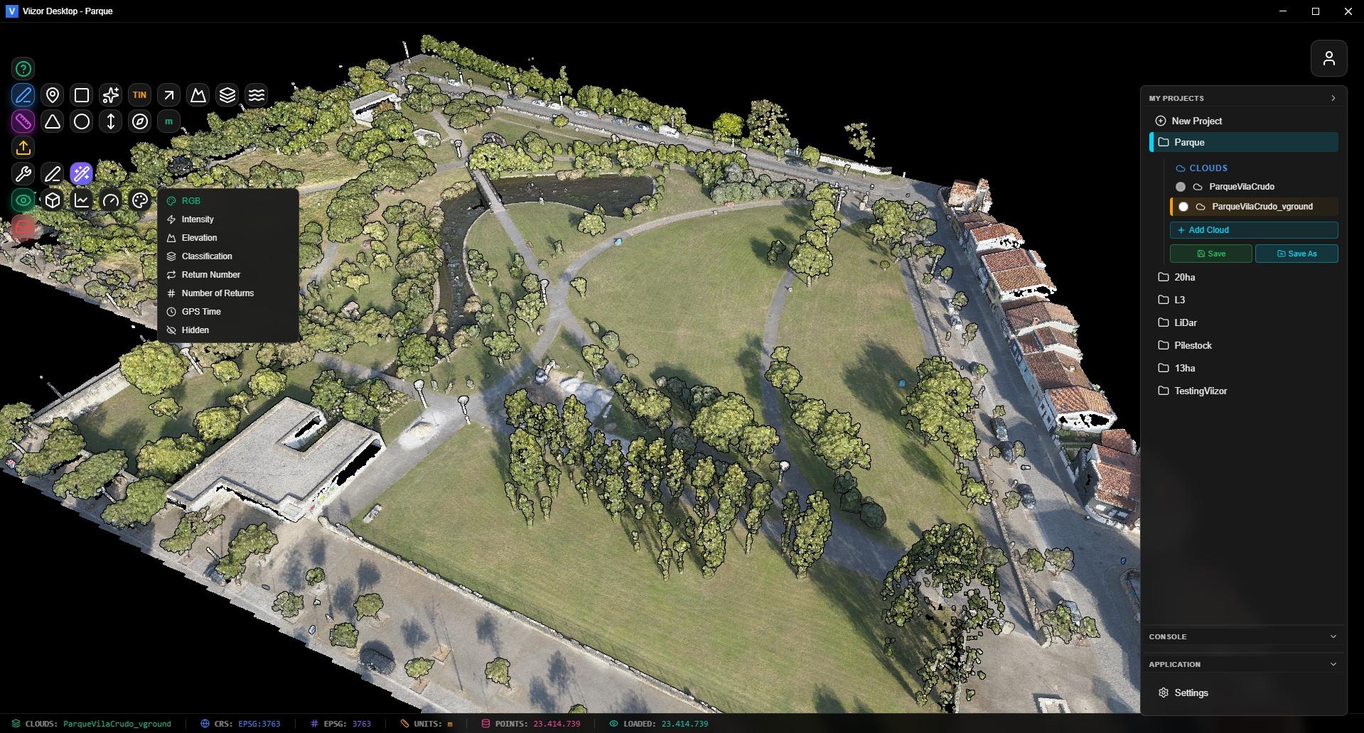
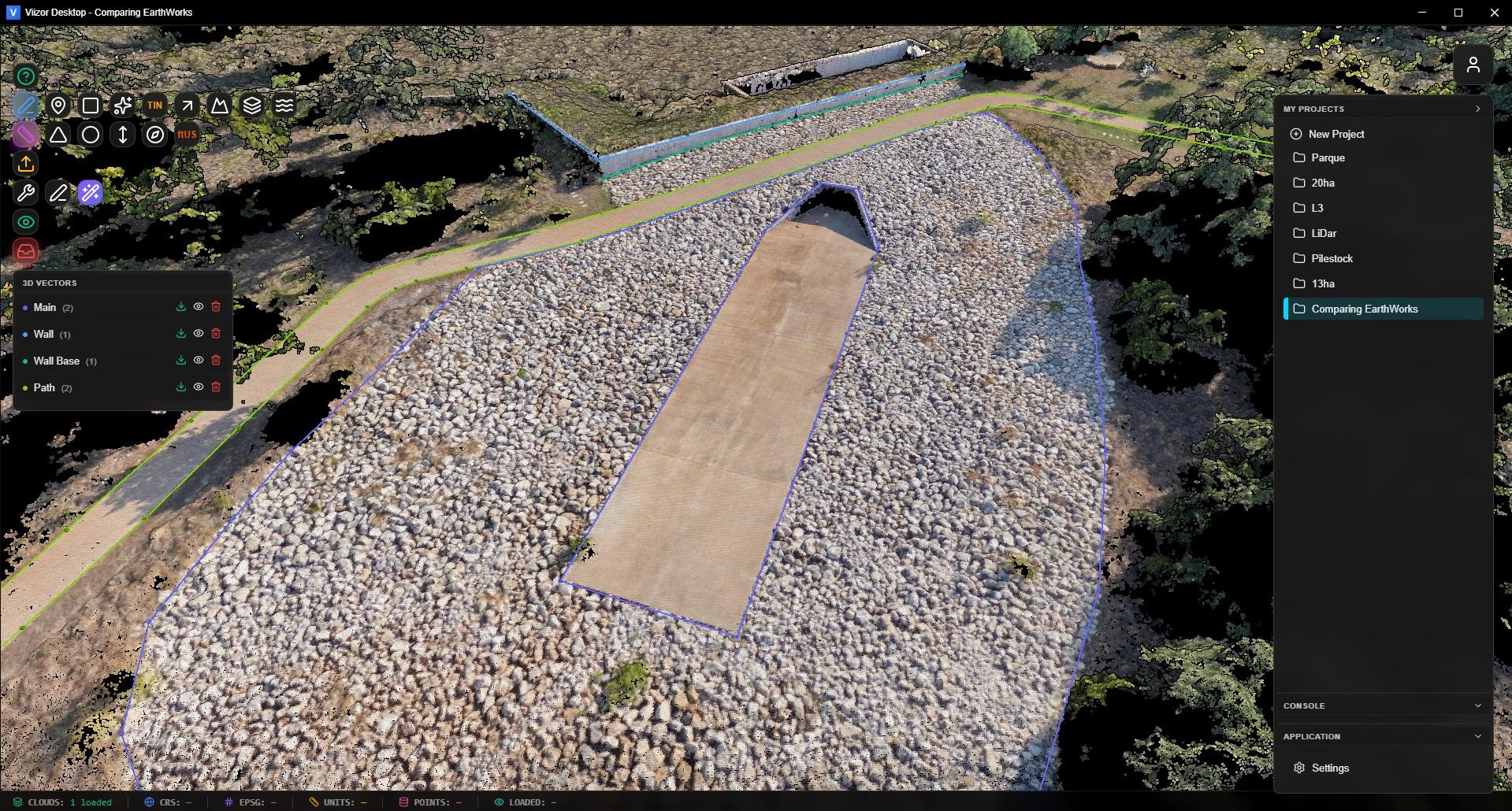
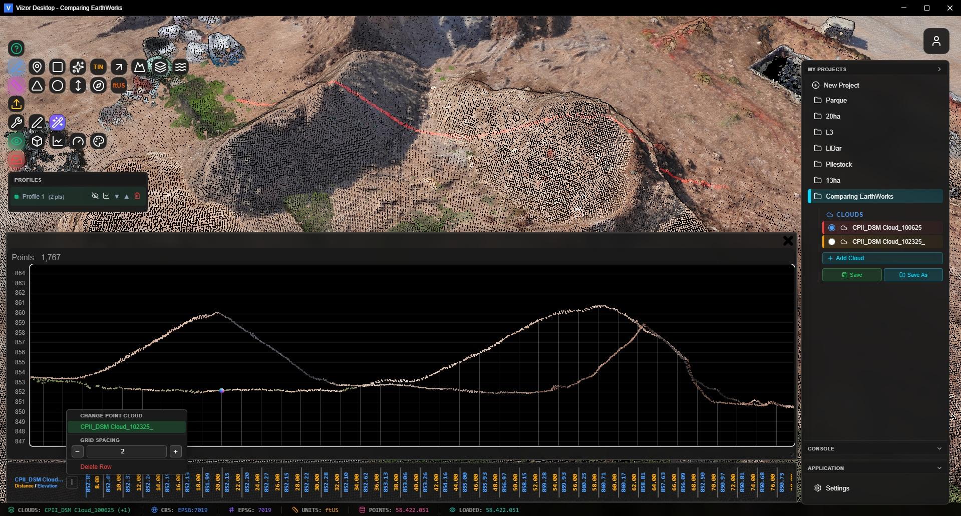
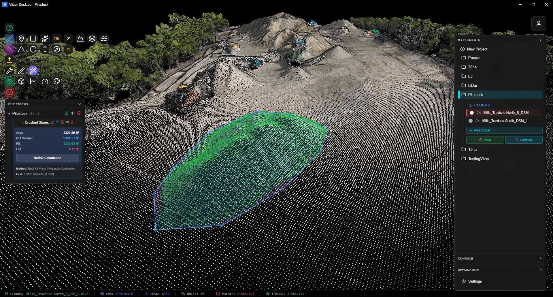
50+ Million Points. Smooth Navigation.

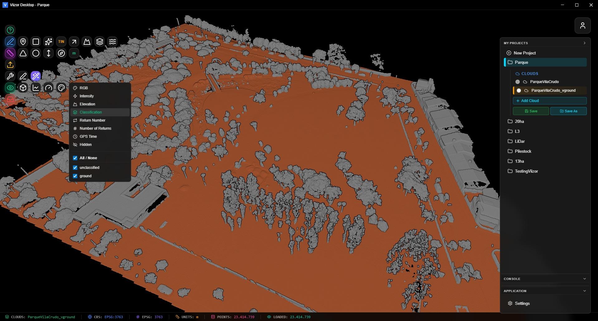
Optimized Potree-based engine handles massive point clouds without lag. Switch between RGB, Intensity, Elevation, Classification with one click.

Works anywhere — office, field site, or offline. Your laptop is the only hardware you need.

  • RGB/Intensity
  • Elevation
  • Classification
  • Fast Rendering
Viizor 3D Visualization

Stockpile Volumes in 3 Clicks

Draw polygon. Get volume. No exporting to spreadsheets. No manual calculations. Select from 98 material densities from the Caterpillar Performance Handbook — crusite limestone, aggregates, coal, topsoil, and more.

Cut/Fill Analysis — Compare two surfaces and see exactly what changed. Color-coded visualization shows where material was added or removed. Know if you moved 50,000 m³ or 52,000 m³ before the dispute starts.

Tonnage, not just volume. A 10% error in density means a 10% error in payment. We handle the math.

  • 98 Densities
  • Tonnage
  • Cut/Fill
  • Reports
Surface Comparison Tool
Point Classification

Ground Classification + Manual Refinement

Automatic PTD classification for fast ground extraction. Configurable parameters for different terrain types.

Lasso reclassification for manual control. Select points, assign class, done. No exporting to other tools.

View by classification, filter by class, export ground-only for clean DTMs.

  • Auto PTD
  • Lasso Fix
  • ASPRS Classes
GCP Alignment Tool

GCPs Don't Match Your Cloud?

Even RTK drones have systematic errors. Your surveyor's control points are in State Plane feet, your cloud is in UTM meters. The height is ellipsoidal, the GCPs are orthometric. Sound familiar?

GCP Alignment applies a 7-parameter Helmert transformation to match your cloud to surveyed control points. Minimum 3 GCPs, 5+ recommended for construction-grade accuracy (<3cm RMSE).

CRS Converter transforms between 8,000+ EPSG coordinate systems. WGS84 to UTM. UTM to State Plane. Automatic geoid correction for NAVD88.

  • Helmert 7-param
  • 8,000+ EPSG
  • Geoid Correction

Professional Survey Tools

Auto Topo Points

Sparks: Auto Topo Points

Generate survey-ready coordinates automatically. Configure grid spacing, filter by classification, export P,N,E,Z,D format ready for Civil 3D import.

3D Vectors

3D Vectors & Polylines

Draw breaklines, roads, boundaries directly on the cloud. Unlimited vertices. Export to DXF with real-world coordinates. AutoCAD-style vertex editing.

Smart Profiles

Cross-Section Profiles

Draw a line, get a profile. Compare surfaces. Extract elevation and distance with one click. Export for earthwork planning and quantity verification.

From Point Cloud to Civil 3D in 3 Clicks

The export format matters. Your CAD team doesn't want a pretty picture — they need surfaces they can design against.

LandXML 1.2 — TIN surfaces with vertices and faces. Import directly into Civil 3D, Carlson, MicroStation. Surface-ready, not just points.

DXF — 3D polylines, contours, polygons with real-world coordinates. AC1006+ compatibility for maximum CAD software support.

TXT (P,N,E,Z,D) — Survey points ready for Civil 3D point import. Name, northing, easting, elevation, description.

  • LandXML
  • DXF
  • Contours
  • TXT Points
Civil 3D Export
Viizor Desktop

Stop Renting Your Tools

Over 3 years, a typical software subscription costs $6,000–$9,000. If you stop paying, you stop working.

Viizor Desktop is a one-time purchase. Use it for one project or one thousand. No recurring fees. No "tiers" that lock features behind higher payments. No surprises.

Full offline capability. Process in the field, on-site, or anywhere. No internet dependency when you need results fast.

  • Perpetual
  • Works Offline
  • One Price

Try It. Keep Your Data. Decide Later.

10 days. Full features. No credit card. Load your biggest file and see if it handles it.
If it doesn't do what you need, you've lost nothing but time.

$540 One-time payment

Perpetual license + 1 year of updates included.

Windows 10/11 • 64-bit • Instant Download

Questions? hello@viizor.app

$540 once — not $540/month. No subscription. Ever.
Free Trial Buy Now