Import LAS/LAZ from any source
Pix4D DJI Terra Agisoft Metashape RealityCapture DroneDeploy Trimble Leica FARO Riegl Velodyne Ouster Livox TopoDOT TerraSolid Global Mapper CloudCompare LAStools Autodesk ReCap Pix4D DJI Terra Agisoft Metashape RealityCapture DroneDeploy Trimble Leica FARO Riegl Velodyne Ouster Livox TopoDOT TerraSolid Global Mapper CloudCompare LAStools Autodesk ReCap

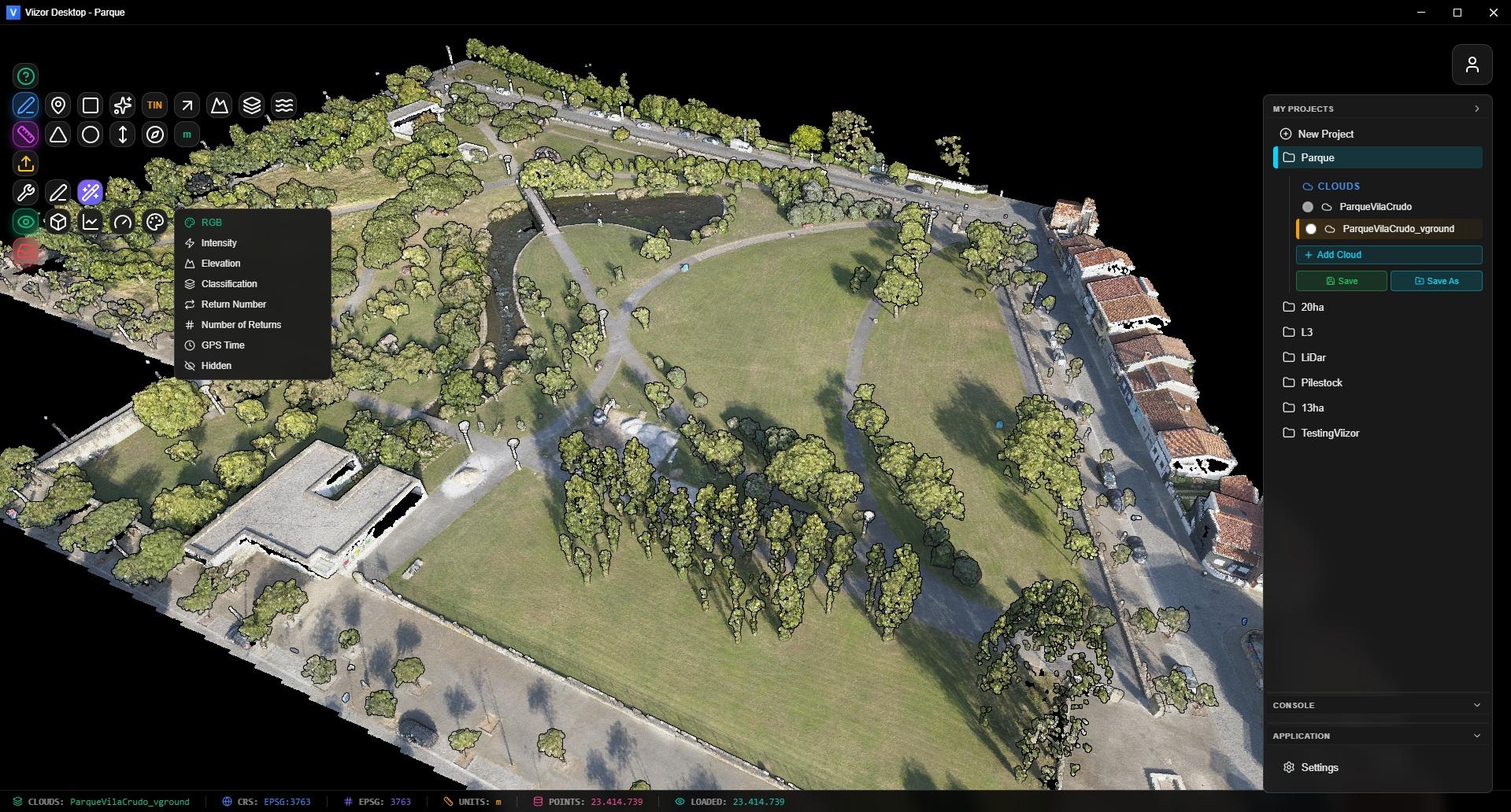
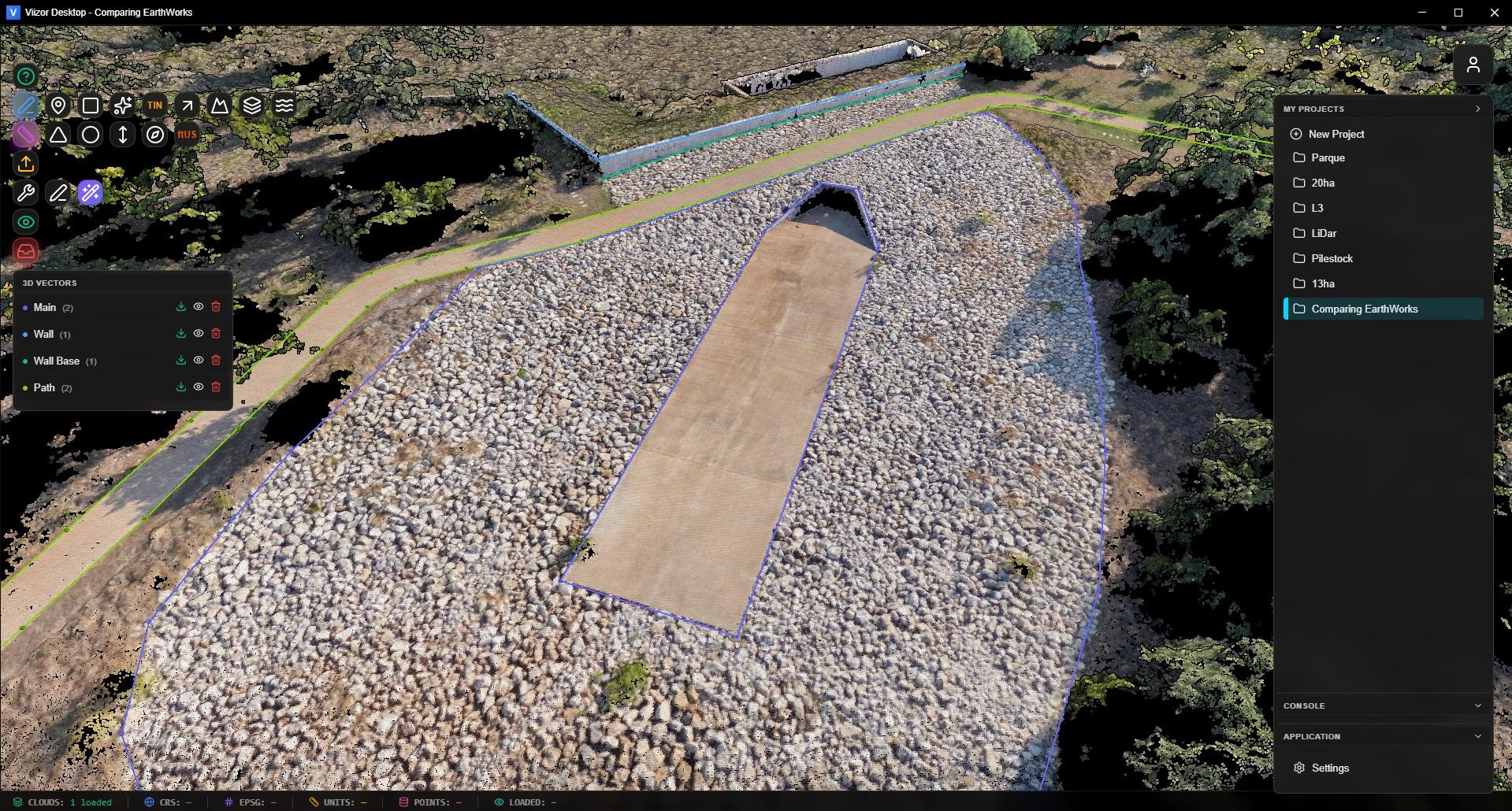
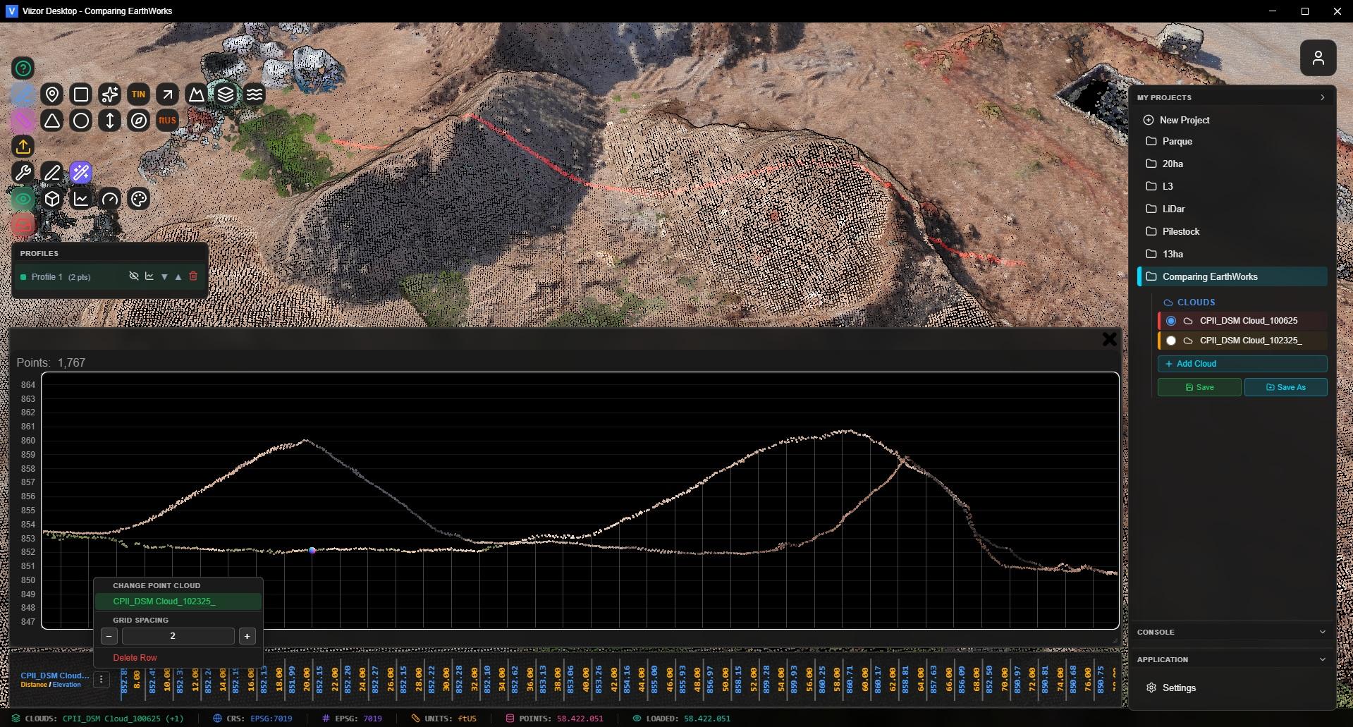
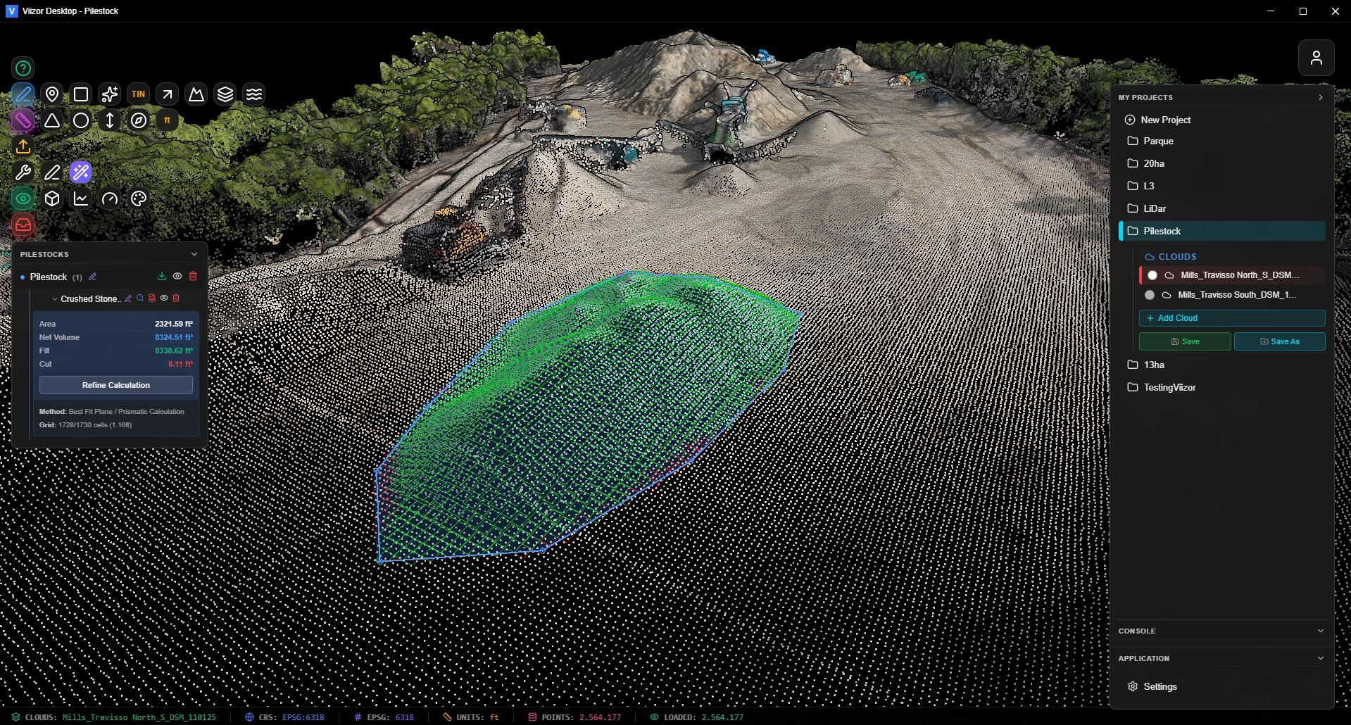
See Your Data Like Never Before

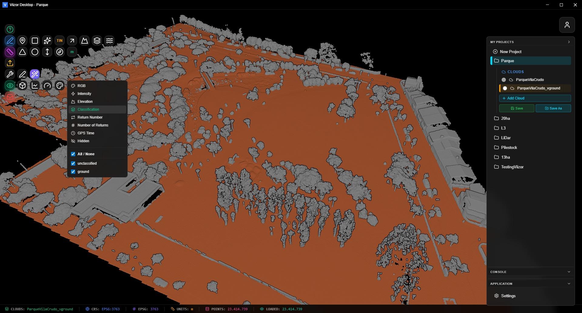
Import LAS and LAZ files instantly. Switch between RGB, Intensity, Elevation, Classification and more with one click.

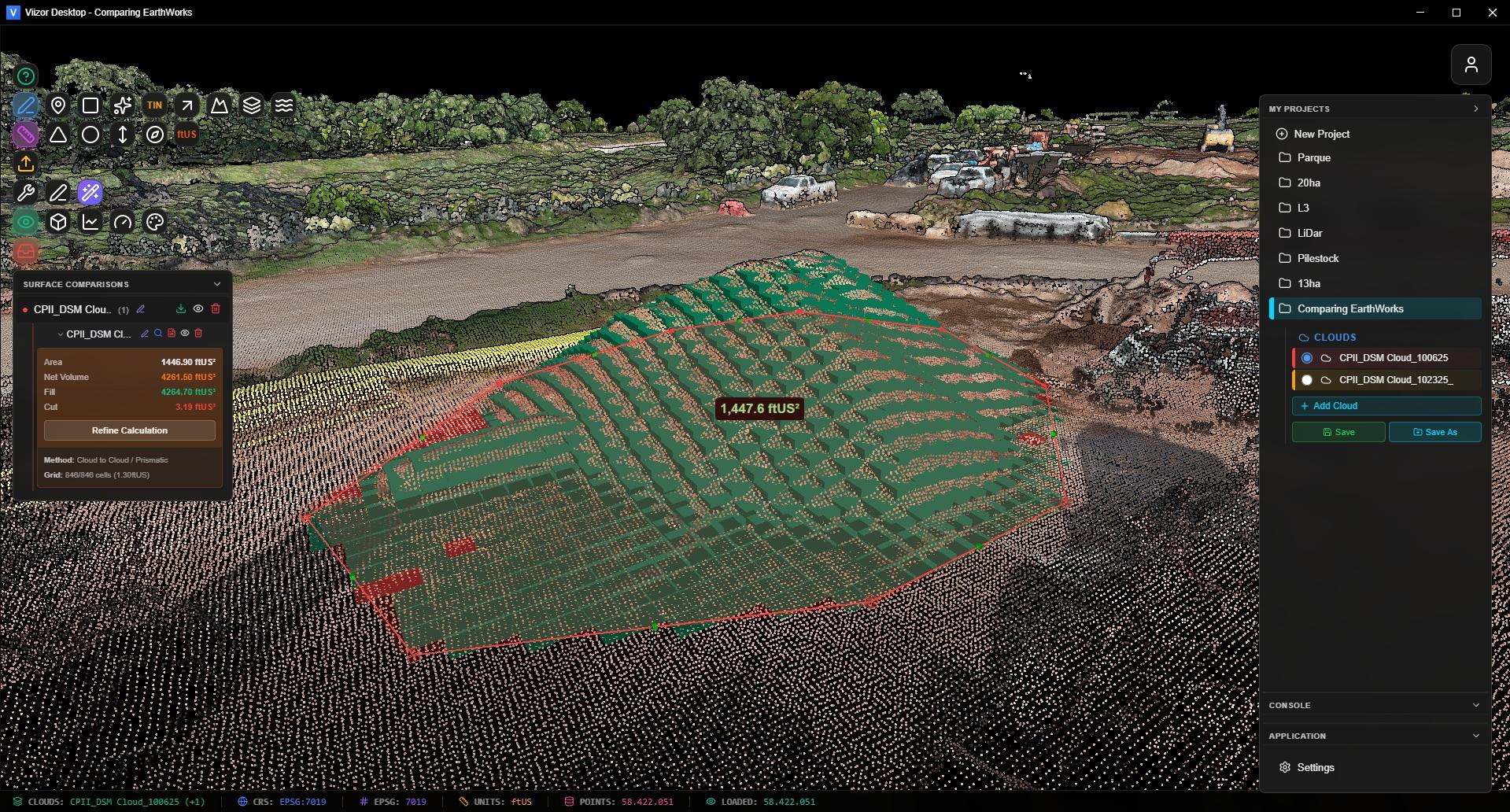
Handle millions of points smoothly with our optimized Potree-based engine. Navigate your point clouds with intuitive controls designed for professionals.

Viizor 3D Visualization

Professional Analysis Tools

Precision Measurement — Distance, area, angle, azimuth, and height with geodetic accuracy.

Volume Calculation — Calculate stockpile volumes with 100+ material densities. Get instant weight estimates.

Surface Comparison — Cut/Fill analysis with color-coded visualization. Export professional PDF reports.

  • Measure
  • Volumes
  • Compare
  • Reports
Surface Comparison Tool
Point Classification

Classification Made Easy

Ground classification is the foundation of terrain analysis. Viizor makes it simple to visualize, filter, and reclassify points with precision.

Use the polygon reclassification tool to manually refine where automatic methods fall short. See your data organized with intuitive color coding.

  • ASPRS Standard
  • Manual Reclassify
  • Class Filtering

Everything You Need

Auto Topo Points

Auto Topo Points

Generate topographic survey points automatically. Configure grid spacing and extract elevation data instantly.

3D Vectors

3D Vectors

Create polylines directly on your point cloud. Draw roads, boundaries, and features with AutoCAD-style precision.

Smart Profiles

Smart Profiles

Generate cross-section profiles with elevation graphs. Compare surfaces and measure vertical distances.

Import & Export Anything

Point Clouds — LAS, LAZ with automatic CRS and EPSG detection.

Vectors — DXF polylines, KML/KMZ from Google Earth, CSV/TXT coordinates.

3D Models — GLTF, GLB, OBJ. Overlay BIM models on your point clouds.

Export — DXF with real-world coordinates. Professional PDF reports.

  • LAS/LAZ
  • DXF
  • GLTF/OBJ
  • PDF
Volume Calculation

Ready to Get Started?

$540 $340 Launch Special

First 50 launch licenses are perpetual + 1 year of weekly updates included.

Windows 10/11 • 64-bit • Instant Download

hello@viizor.app

Launch Special: $340 (was $540) — First 50: Perpetual + 1 year updates
Free Trial Perpetual License